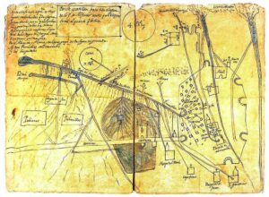
Distribution plan of the waters of the Alfacar or Aynadamar ditch in Granada at the end of the 16th century – mid-17th century.

Distribution plan of the waters of the Alfacar or Aynadamar ditch in Granada at the end of the 16th century – mid-17th century.